Find

your

winning

location

in

5

mins

Try Aino — your AI data analyst for business growth.

Trusted by industry leaders

Join 2500+ project teams worldwide

See how it works

Save 100+ hours on manual GIS work.
No code. No GIS expertise needed.

Step 1

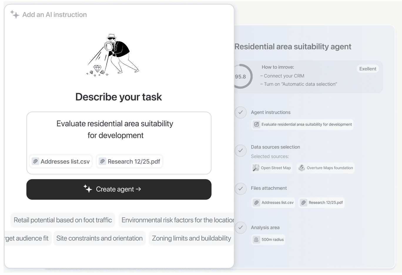
Ask questions
in plain language

Ask questions in plain language

Ask questions in plain language

Type your question about any location. Aino's AI will design
the methodology and run the analysis—no coding needed.

Type your question about any location. Aino's AI will design the methodology and run the analysis—no coding needed.

Step 2

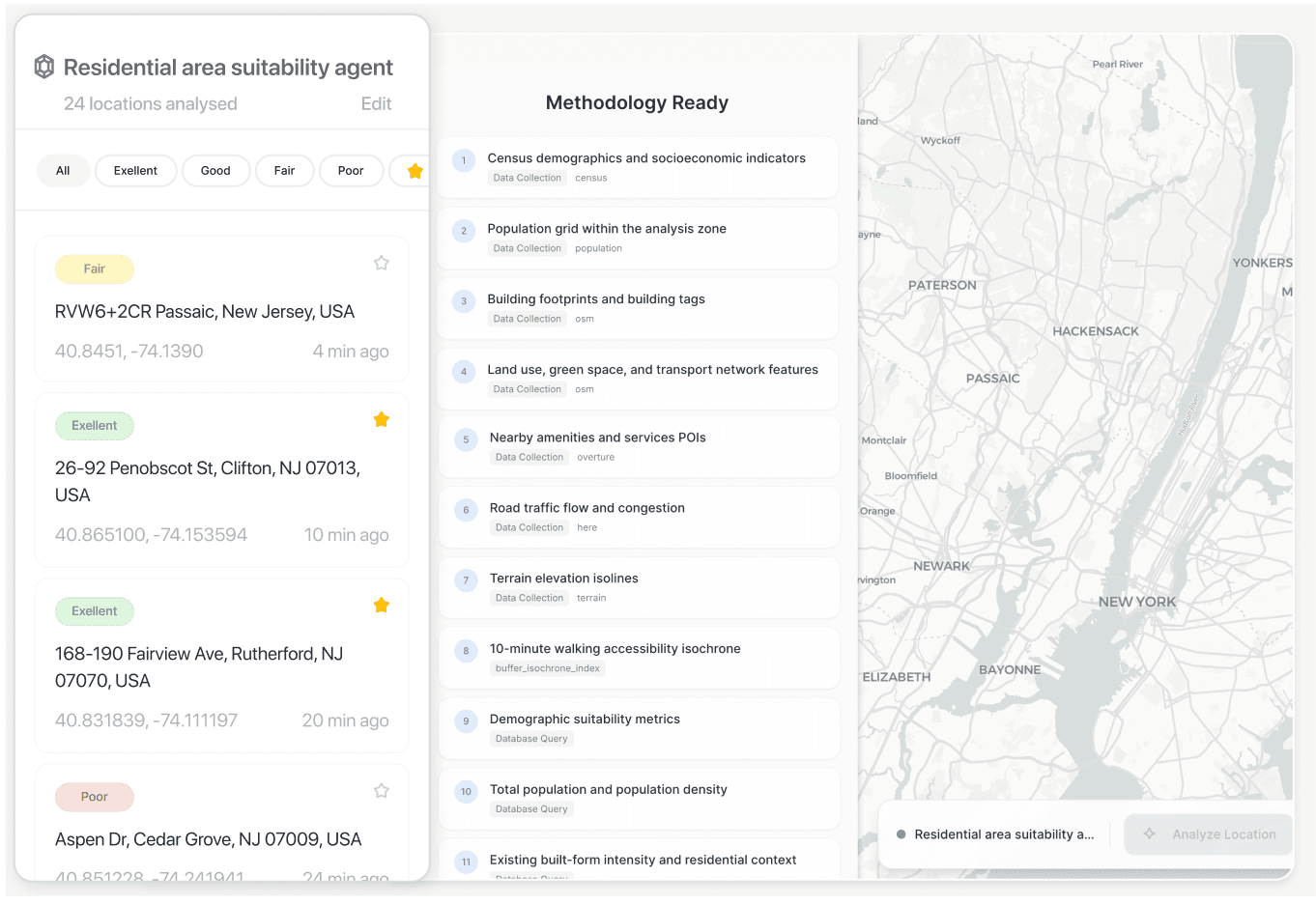
Set up your project data

Enhance your site data in Aino—upload a file, connect
a PostgreSQL database, or explore using Aino’s built-in data sources.

Enhance your site data in Aino—upload a file, connect a PostgreSQL database, or explore using Aino’s built-in data sources.

Enhance your site data in Aino—upload a file, connect a PostgreSQL database, or explore using Aino’s built-in data sources.

Step 3

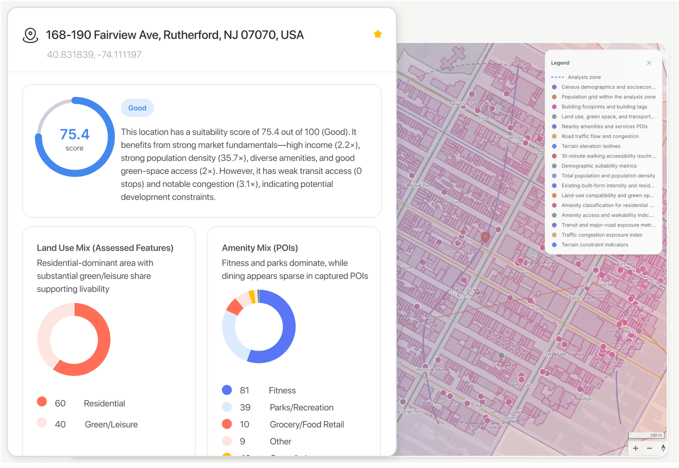
Get instant visual insights

View results as interactive maps and dashboards—
ready to explore, present, or share. No extra tools required.

View results as interactive maps and dashboards—ready to explore, present, or share. No extra tools required.

View results as interactive maps and dashboards—ready to explore, present, or share. No extra tools required.

Step 4

Share and collaborate in real time

Invite your team to view or edit. Export files or share live dashboards instantly to keep projects moving fast.

See how it works

Save 100+ hours on manual GIS work.
No code. No GIS expertise needed.

What makes Aino different

AI built for location analysis:
Aino vs. General Models

Identify the optimal location for opening a new sporting goods store in Seattle, considering population data and competitor analysis |

Smart AI analyst mode

Result

Aino AI

Best for location analysis, urban planning and real estate

Outputs interactive maps and dashboards

Performs real spatial and geographic data analysis

Aino AI

Best for location analysis, urban planning and real estate

Outputs interactive maps and dashboards

Performs real spatial and geographic data analysis

General purpose model

Best for content creation, Q&A,
and summaries

Outputs text only, does not offer GIS data visualization

Analyzes general information without spatial data

General purpose model

Best for content creation, Q&A,
and summaries

Outputs text only, does not offer GIS data visualization

Analyzes general information without spatial data

What can Aino do for you?

AI GIS analyst,
built to augment your project teams

AI GIS analyst, built to augment your project teams

Trusted GIS analysis

Get site analysis in minutes by simply asking questions—no expertise needed.

Interactive mapping

Create maps and dashboards instantly to visualize your results clearly.

Seamless CAD & GIS integration

Export in JSON, CSV, PDF, PNG,
or DXF—or sync with Google Sheets.

Curated data at your fingertips

Access 400+ cities’ worth of datasets, including POIs, street data, building footprints, and social metrics.

Flexible data input options

Connect your own Postgres database or upload files securely to enrich your projects.

Collaboration without the chaos

Work in real-time with your team—
no more tedious exports or version conflicts.

FAQ

Know more about Aino

What is Aino AI?
icon

Aino AI is an agentic system — a combination of multiple AI models that can perform GIS analysis with human-level precision.

Do I need GIS experience to use Aino?
icon

No. Aino is designed for users of all backgrounds. You can start building projects without any prior GIS knowledge.

Can I use my own data?
icon

Yes, Aino supports standard GIS formats like GeoJSON, CSV, KML, GeoPackage, and even connects to Postgres.

Is my data safe with Aino?
icon

Yes. Your data is only accessible to you and your project team. Public visualizations are shared only when you choose to publish.

Can I try Aino for free?
icon

We don’t offer a standard free trial due to infrastructure costs, but we’re happy to provide access for organizations. Book a call to discuss.

Where does Aino’s data come from?
icon

We use open sources like OpenStreetMap, Overture Maps, and official city open data from over 20+ regions. Read more at "Data Sources" page.

How do I share my results?
icon

You can share a project via link or export in formats such as PNG, PDF, CSV, DXF, or JSON.

FAQ

Save hundreds of hours on data work. Use Aino.

Aino AI vs. General Models

Same prompt, different results

Identify the optimal location for opening a new sporting goods store in Seattle, considering population data and competitor analysis |

Smart AI analyst mode

Result

Aino AI

Best for location analysis, urban planning and real estate

Outputs interactive maps and dashboards

Performs real spatial and geographic data analysis

ChatGPT (GPT-4.5)

Best for content creation, Q&A,
and summaries

Outputs text only, does not offer GIS data visualization

Analyzes general information without spatial data

What makes Aino different

AI built for location analysis:
Aino vs. General Models

Aino AI

Best for location analysis, urban planning and real estate

Outputs interactive maps and dashboards

Performs real spatial and geographic data analysis

General purpose model

Best for content creation, Q&A,
and summaries

Outputs text only, does not offer GIS data visualization

Analyzes general information without spatial data

Identify the optimal location for opening a new sporting goods store in Seattle, considering population data and competitor analysis |

Smart AI analyst mode