– Solutions · Urban Planning
– Trusted by leading planning and architecture studios








"Aino replaced the 5-day process of finding, cleaning and formatting location data. Now it happens before the first client meeting."
– Urban Planning Principal, international architecture firm, NYC
01
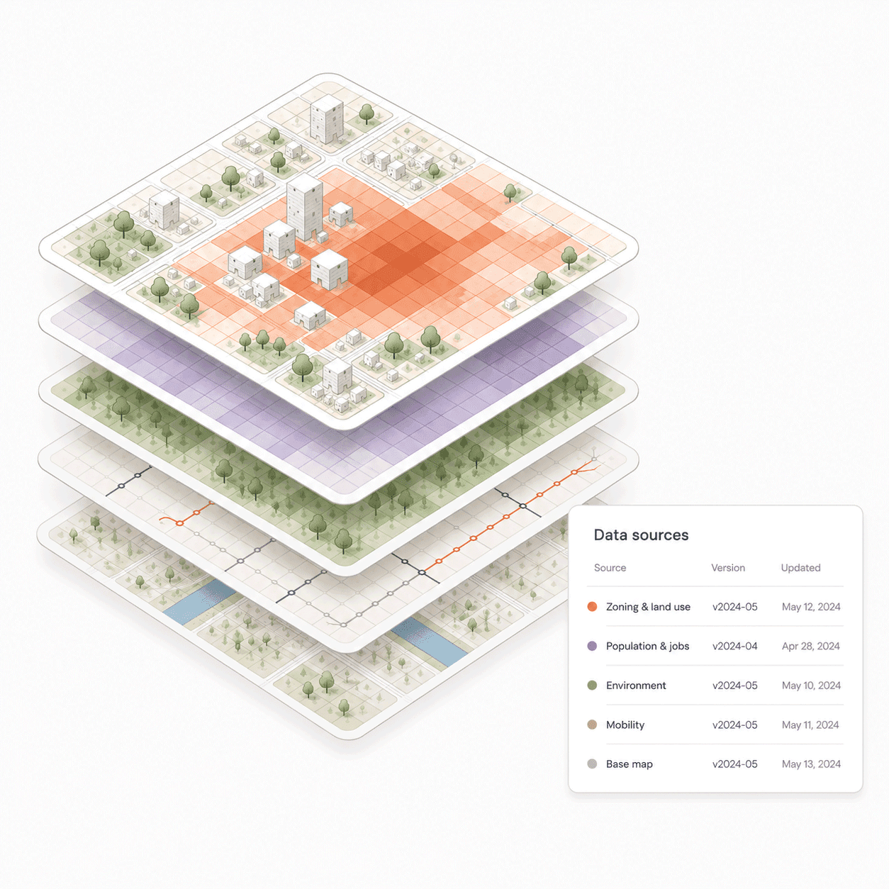
Site analysis that defends itself
Every finding comes with source attribution, dataset version and methodology. Walk into any client meeting or planning hearing and answer exactly where every number came from.
— Zoning, density, mobility and environmental analysis in one query
— Every result sourced and traceable
— Defensible methodology for planning submissions and jury panels
— From address to structured analysis in 15 minutes
02
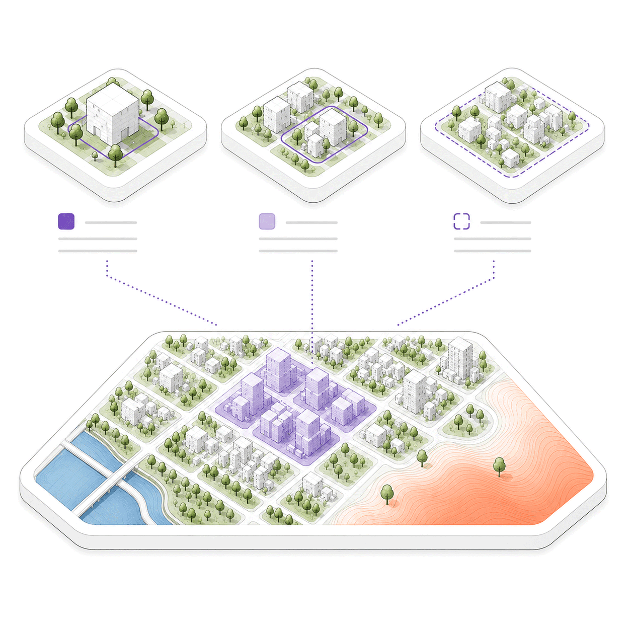
Analyse at any scale — plot to district
Run analysis at the site level, the neighbourhood level or across an entire city. Compare scenarios, identify constraints and surface opportunities — before the design process starts, not after.
— Multi-scale spatial analysis in one workspace
— Scenario testing and side-by-side comparison
— Constraints and red lines flagged automatically
— 3D geometry export for Rhino and AutoCAD
04
Your whole team runs analysis.
Not just the GIS specialist.
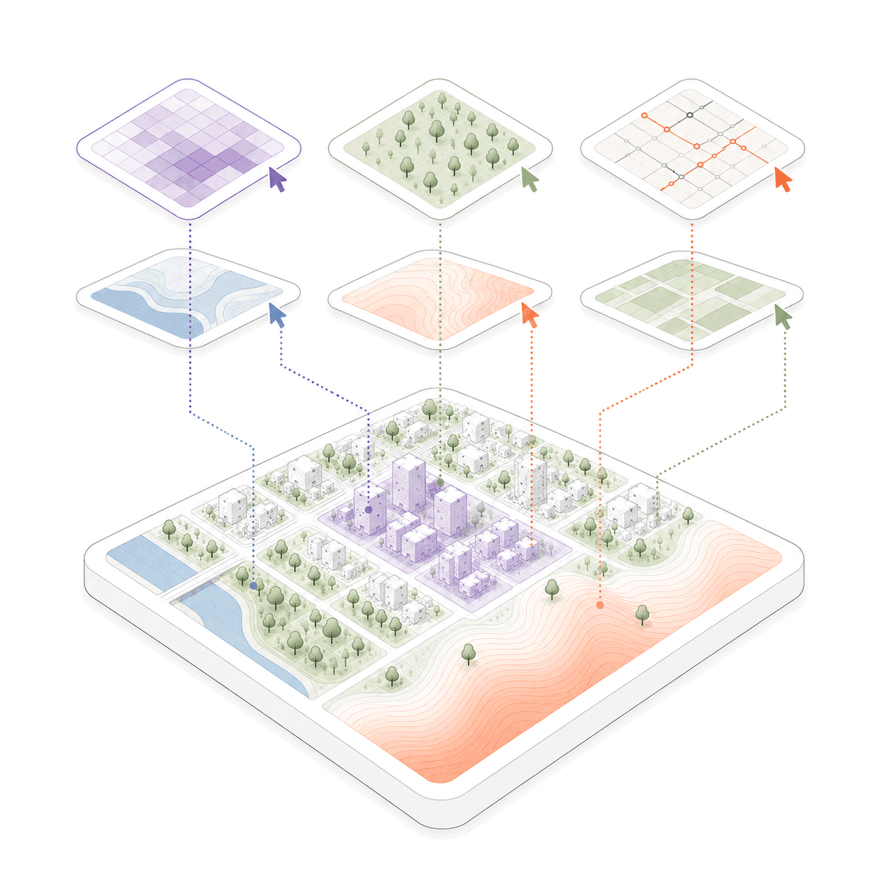
Ask in plain language. Aino handles the spatial logic — data retrieval, layer operations, calculations. Planners, architects and urban designers get rigorous results without waiting on a specialist or learning new software.
— Natural language to spatial result
— No GIS or scripting skills required
— Same analytical standard across every team member
— 10+ data sources connected automatically
04
Every analysis saved.
Every city remembered.
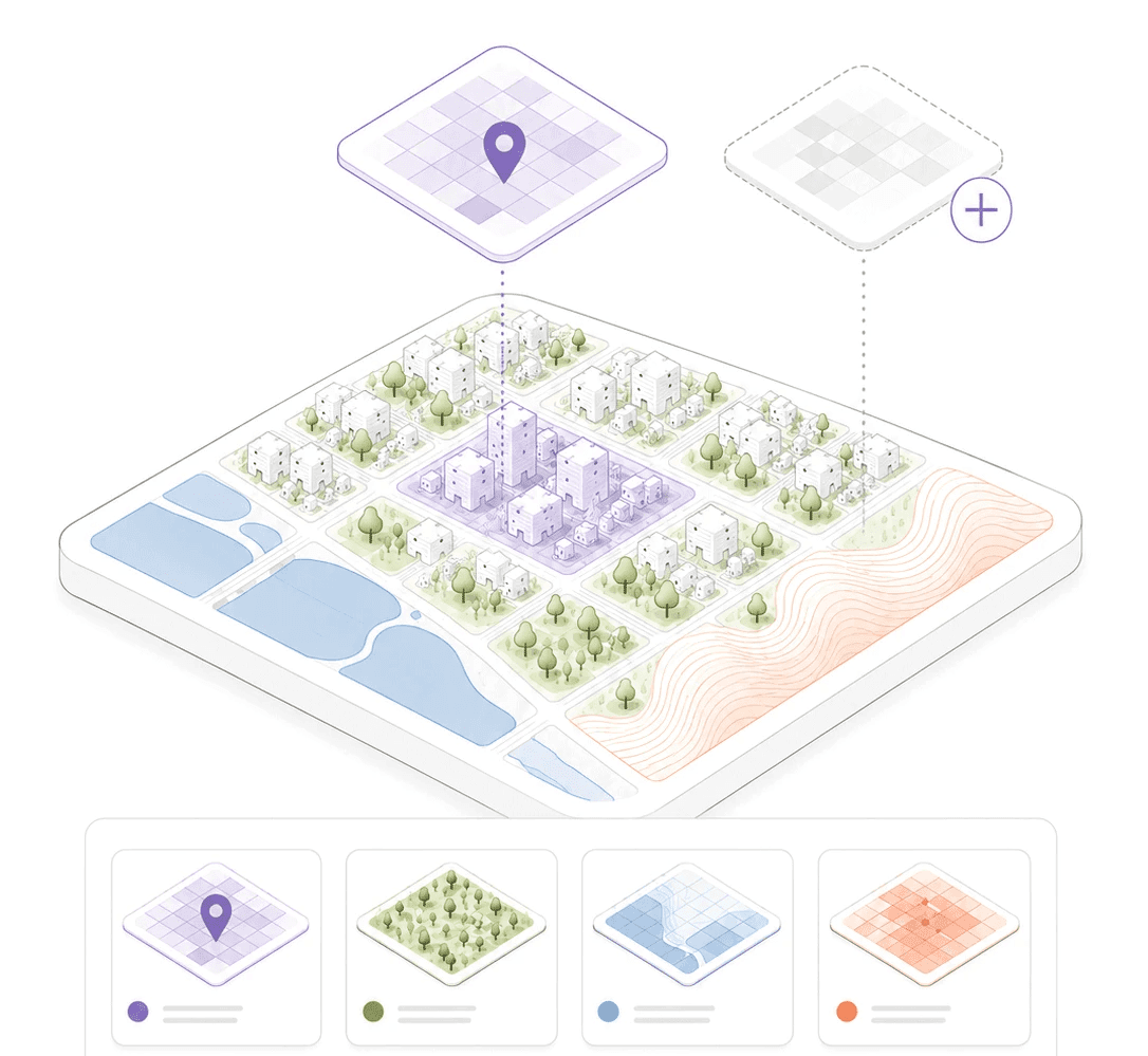
Every spatial analysis your team runs is saved in a shared workspace — searchable by city, typology or project. When a new commission arrives for a familiar location, you start from what the team already knows.
— Cross-project spatial search
— Reusable analysis templates by typology
— New team members start from existing studio knowledge
— Spatial context survives staff turnover
See it in action
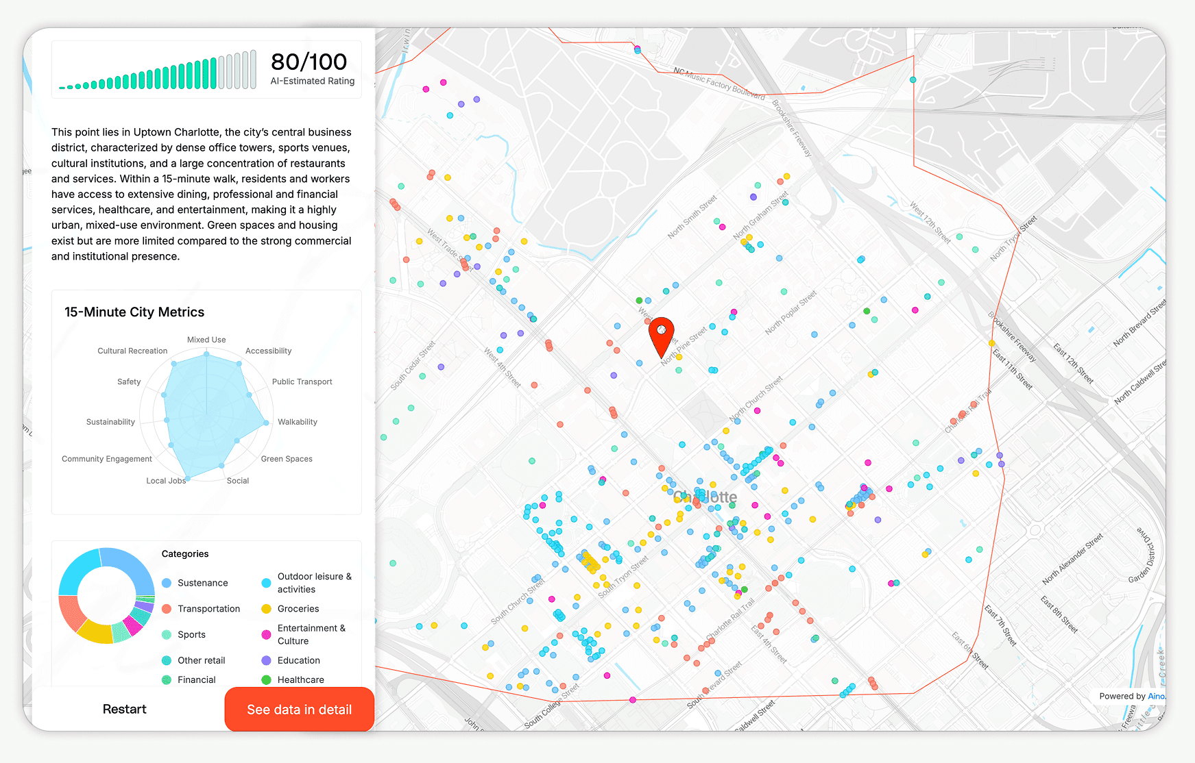
The 15 Minute City tool is built on the same spatial analytics engine as Aino. Pick any address — your next project site, a city you are planning for, or just your own neighbourhood. See what Aino sees.
Free. No account required. Export the full analysis directly into Aino when you are ready.
"We used to spend days sourcing context data for every new site. Now it takes 15 minutes and the analysis goes straight into the planning submission."
Project Lead, urban planning studio
"For the first time, everyone on the team — not just the GIS analyst — can run a proper site analysis. The rigour is the same. The time is not."
Managing Partner, architecture studio
"Aino became the analytical baseline for every project. The whole team works from the same data and the same methodology."
Head of Urban Design, planning consultancy